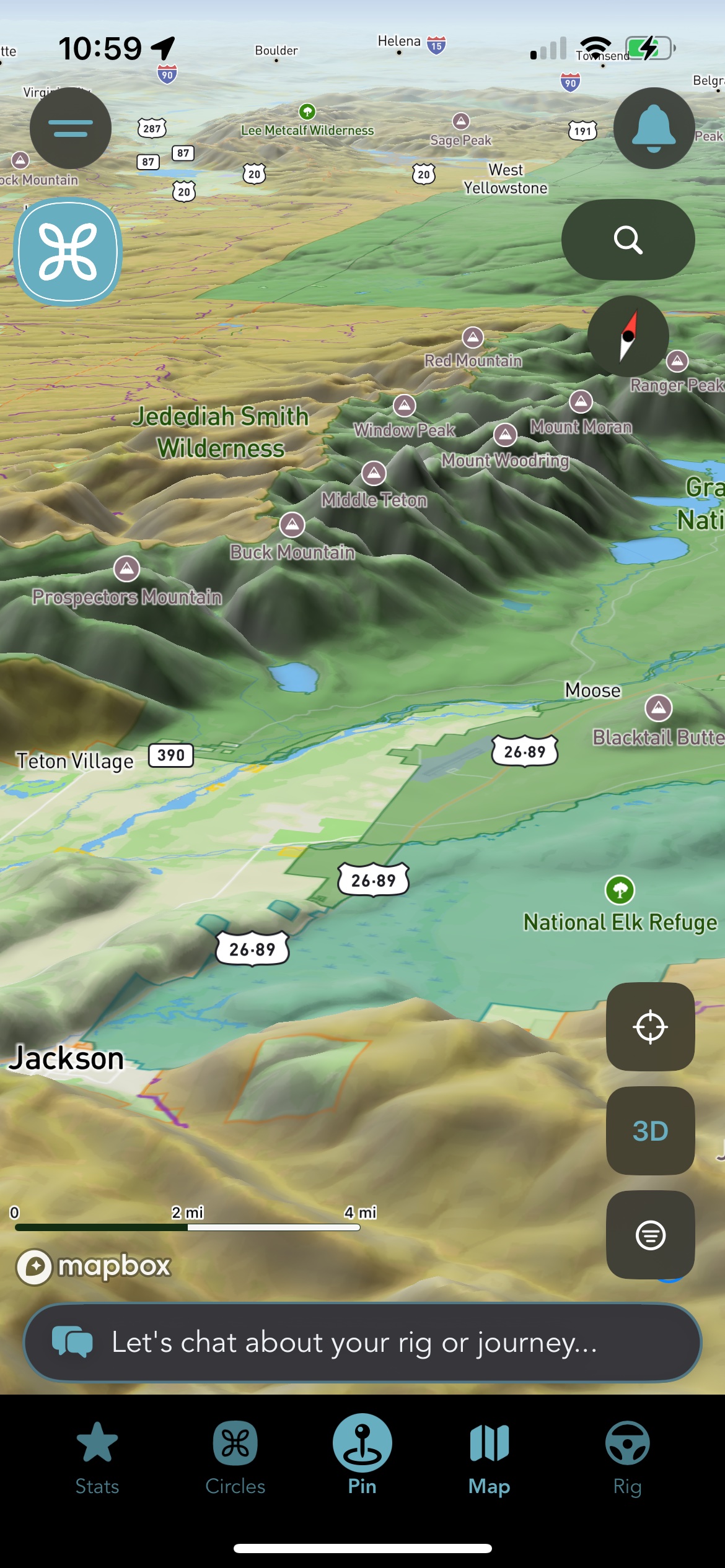
You've been able to see BLM and National Forest land on the Grover map for a while now, gold and orange boundaries that are easy to pick out at a glance. What you couldn't see was almost everything else the federal government manages: national parks, wildlife refuges, and the reservoirs and dam land the Bureau of Reclamation controls.
That data has actually been in Grover's map pipeline since we unified our public-lands dataset. It was fetched, built, and refreshed every month right alongside BLM and National Forest. It just never got drawn on anyone's screen. As of this week, it does.
"We had the data. We just weren't rendering three-fifths of it. Now you can see all of it."
Three new layers, live now on both iOS and Android: National Parks, Wildlife Refuges, and Reclamation Land.
Three New Chips in the Public Land Row
Open the map, tap Layers, and you'll find the three new chips sitting in the same Public Land row as BLM and National Forest. Each one gets its own color, chosen so nothing blurs together even when several categories overlap in the same view:
- National Parks — forest green
- Wildlife Refuges — teal
- Reclamation Land — brown
That's alongside the BLM gold and National Forest orange you already know. All three new layers default on, so if you haven't touched your Layers tab recently, you're probably already looking at them without realizing it.
Same interaction as everything else on the map. Boundaries fill in at a light opacity so the base map stays readable, with a solid outline once you're zoomed in close enough to be useful. Tap any parcel for a quick read on what it is.
Read Before You Park
This is the part worth slowing down for. BLM and National Forest land is, generally, land you can disperse-camp on. National parks, wildlife refuges, and reclamation land are a different category entirely, and a lot more of it restricts or outright prohibits the kind of overnight stay you might be used to on BLM.
Tapping a parcel in one of the three new layers surfaces a note specific to that category, because the honest answer is "it depends," and it depends on exactly which agency manages exactly which piece of ground. A wildlife refuge might allow a pull-off during daylight hours and nothing overnight. A reclamation reservoir might allow camping in a designated area and nowhere else on the same shoreline. A national park is usually the most restrictive of the three.
Heads up: read what a parcel actually allows before you treat it the way you'd treat a BLM tract. The layer tells you whose land it is. It doesn't substitute for checking the rules that apply to that specific piece of it.
How to Turn It On
- Open the map in Grover and tap Layers.
- Find the Public Land row — National Parks, Wildlife Refuges, and Reclamation Land now sit alongside BLM and National Forest.
- Tap a parcel for details on what it is and what it allows.
- Toggle any layer off if you'd rather see fewer boundaries at once.
These three layers work alongside everything else already on your map: community pins, your bucket list, saved locations, and the LandTrust properties that opened up private recreational land earlier this year. Between all of it, you've now got a genuinely complete read on who owns the ground around you, public or private.
We built the public-lands dataset once and are still catching up on rendering all of it. Parks, refuges, and reclamation land are the next three pieces, live today on both iOS and Android. If you're planning a trip through country you don't know well, open the map before you go and see what's actually out there.
See What's Actually Around You
Open the map, turn on the new layers, and get a real picture of the public land near your next stop.